Restaurant, café, bar
Serving visitors to this site? Appear here.
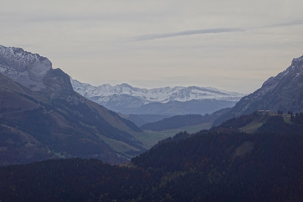
Become a partnerIconic summit at 2,525 m elevation offering a 360° panorama over the Mont-Blanc massif, Beaufortain, Aravis, Fiz and Bauges ranges.
Mont Joly is a 2,525 m summit located in the Beaufortain massif, on the border between Saint-Gervais-les-Bains, Megève and Les Contamines-Montjoie, in Haute-Savoie. A true natural viewpoint facing the Mont-Blanc massif, it offers an exceptional 360° panorama from its summit, where an orientation table is located.
Mont Joly is accessible via several hiking routes, with the main starting points at Saint-Nicolas-de-Véroce (Plateau de la Croix), Bettex via Les Communailles, Planay hamlet from Megève, or Baptieu hamlet from Les Contamines-Montjoie. The climb is challenging and sustained, crossing alpine meadows and forests before reaching the mineral ridges of the summit.
The summit features technical installations (mountain rescue radio relay, weather antennae) and a visitor logbook box. Hikers can reach the summit via two main variants: Épaule du Mont Joly (the most frequented route) or Panse (less-used route). The ascent passes through several remarkable points: Mont Joly refuge (2,002 m), Mont Géroux (2,288 m), and the arrival of the Épaule chairlift (closed in summer).
From Sallanches (A40 exit 20), reach Saint-Gervais-les-Bains then Saint-Nicolas-de-Véroce (D909). Parking at Plateau de la Croix. From Megève, reach Planay hamlet via Côte 2000 (direction Altiport). From Les Contamines-Montjoie, take the Notre-Dame-de-la-Gorge road (D902), turn right on the Echenaz path, continue to Baptieu parking.
Open in MapsBike access possible to departure parking areas (Plateau de la Croix, Bettex, Planay), but the rest of the route is on foot only.
Open in MapsServing visitors to this site? Appear here.
Become a partnerShare your hours and specialities with visitors.
Become a partnerB&B, gîte, campsite, holiday let.
Become a partnerBeen there? Share your photos — we'll add them to this page with credit. Tag #loisirs74 or email photos@loisirs74.fr
Yes, access to Mont Joly is free and free of charge year-round. Only the Mont d'Arbois cable car (to shorten the route from Megève) is paid.
Mont Joly is accessible via several routes. The departure from Plateau de la Croix (Saint-Nicolas-de-Véroce) is the most direct: 4 km, 1,000 m elevation gain, approximately 3 hours ascent. From Bettex (Les Communailles): 5 to 6 hours round trip. From Megève (Planay hamlet): 6 to 8 hours round trip.
The Mont Joly hike is challenging and reserved for experienced hikers. Elevation gain of 850 to 1,200 m depending on the route. The slope is sustained after Pavillon du Mont Joly, with steep and rocky passages on the summit section (Épaule or Panse). Bring proper hiking boots, water and warm clothing.
No, there is no refuge at the Mont Joly summit. The Mont Joly Chalet-Refuge is located at 2,002 m elevation, before the final ascent. It offers meals and lodging by reservation. From the refuge, allow another 1.5 to 2 hours to reach the summit.
Yes, dogs are allowed on Mont Joly trails but must be kept on a leash, especially in alpine meadows where cattle, goats and sheep graze from June to September. Mont Joly is not located in a nature reserve.
The best period for Mont Joly extends from June to October. July and August offer the most stable conditions. September and early October are ideal for solitude and light. Late May and early June: persistent snowfields. In winter: ski touring or snowshoeing only.
Multi-source verification at publication date. Information may change — confirm with the official operator before travelling.
Nearby
More places to explore in this zone and category
The largest leisure park in Mont-Blanc country: 30 hectares of nature at the foot of the Contamines Nature Reserve, with mountain lakes, free swimming beach and over 20 activities for the whole family.
Tree-climbing adventure park at the foot of the Aiguilles Croches with 70 stations spread over 3 difficulty levels, including a 90-meter zip-line.
A 30-metre waterfall carving turquoise pools, nestled in forest 30 minutes' walk from Megève town centre.
Paragliding and hang gliding takeoff site facing the Mont-Blanc massif, ranked among the world's most beautiful free flight spots, accessible by car at 1,360 m altitude.
 Free
Free
The Col des Aravis links La Clusaz, in Haute-Savoie, with La Giettaz, in Savoie, at 1,486 m.
 Free
Free
Limestone plateau in the Bornes massif at 1,450 m altitude, an important memorial site of French Resistance and Natura 2000 classified natural site.