About Lac Bénit
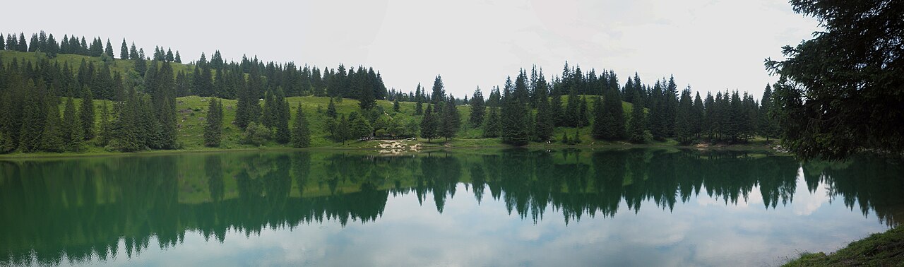
The Lac Bénit is a small 4.1-hectare glacial lake, up to 8.7 m deep, at 1,452 m in the commune of Mont-Saxonnex, at the foot of the limestone cliffs of the Bargy massif. The site is listed under Natura 2000 and is covered by a permanent municipal order that strictly regulates all activities.
Swimming, boating, camping, ground fires, motor vehicles and drone overflight are prohibited. Access to the Lac Bénit is on foot only, from the Bété or Morsulaz car parks. A seasonal refreshment bar operates in summer. Since 6 January 2026, a municipal order has closed the Bété trail; only the climb from Morsulaz remains usable.
What you can do there
Climb up from Morsulaz
Steeper than the Bété route, around 1 h 15 up. A significant average gradient through the pastures under the ski lift.
Observe the Natura 2000 wildlife
The lake is home to the alpine newt, common frog, toad and salamander. Species and plants protected: stay on the paths, pick nothing.
Picnic on site
A picnic area is present by the lake, according to the Tourist Office. Carry out your waste; no facilities outside the seasonal bar.
Take a break at the bar
Alpine refreshment bar open from Pentecost to late September. Precise opening hours not published on an official source; hours vary with weather and attendance.
See the 'eyes of the Bargy'
Two characteristic circular cavities in the Petit Bargy cliff, visible from the trail and the lakeside.
Bivouac under the rules
Bivouac allowed only between 7 pm and 9 am, no ground fires (stove permitted). Bivouac around the lake itself is prohibited.
Practical info
How to get there
By car
From Cluses, follow the RD4 then the RD286 towards Mont-Saxonnex. In the village, head up towards Morsulaz. The Morsulaz car park is at the foot of the ski lift. The Bété car park is about 1 km before Morsulaz, at the signposted sharp bend marked 'Lac Bénit'. Bété trail closed since 06/01/2026: access via Morsulaz only.
When to visit
The site is reachable on foot year-round, but here are the useful seasons:
- June – September: bar open, lake clear, active alpine pastures. Herds and wildlife: stay on paths, dogs on leash.
- Pentecost – late September: bar open depending on season.
- October – May: snowy or muddy trail depending on weather, bar closed. Avalanche awareness in winter.
Where to eat, drink, stay nearby
Photos of Lac Bénit


Share your photos: tag #loisirs74 on Instagram or email them to photos@loisirs74.fr. We pick the best and credit them to you.
Frequently asked questions
Can you swim in the Lac Bénit?
Is the Lac Bénit accessible right now?
Can I bring my dog to the Lac Bénit?
Is there parking at the Lac Bénit?
Is the hike to the Lac Bénit suitable for children?
Is there a refreshment bar at the Lac Bénit?
Is bivouac allowed at the Lac Bénit?
Are drones allowed at the Lac Bénit?
How big is the Lac Bénit?
- Commune de Mont-Saxonnex — Arrêtés permanents et non permanents (site du Lac Bénit)
- Cluses Arve & montagnes Tourisme — Le Lac Bénit – Randonnée
- Haute-Savoie Mont-Blanc Tourisme — Lac Bénit (Mont-Saxonnex)
- Wikipedia — Lac Bénit (fiche lac, surface, profondeur, altitude)
Cross-checked across multiple sources at publication date. Information may change — confirm with the official operator before a specific visit.